
The Cliffs of Moher from the Burren side
South of Doolin the land ends abruptly in a wall of dark rock dropping to the Atlantic. Go early or late, keep well back from the edge, and give yourself time.
Ground: Road and pathFrom Ballyvaughan: Under an hour by carWay in: Via Lisdoonvarna or the coast roadBring: Windproof, sturdy shoes, binoculars, snacks, patience
A different rock
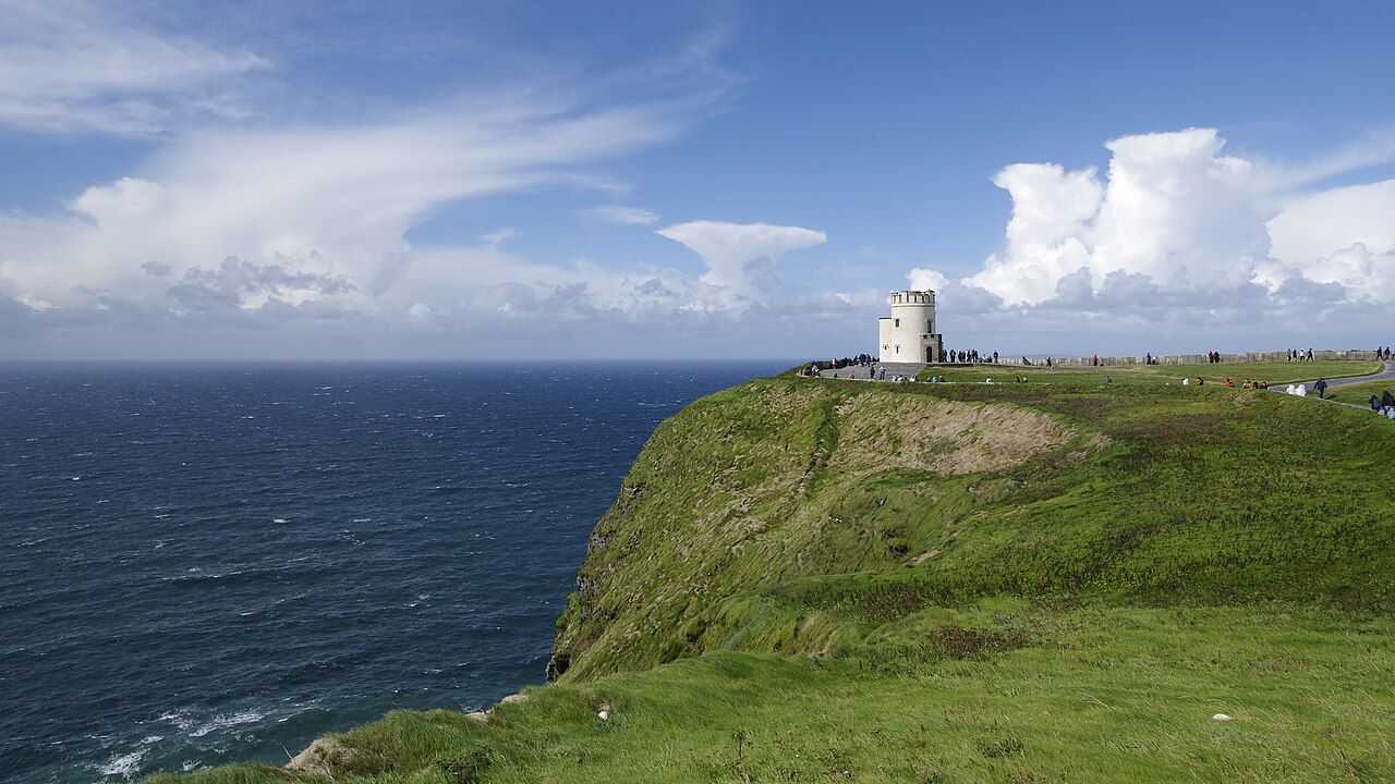
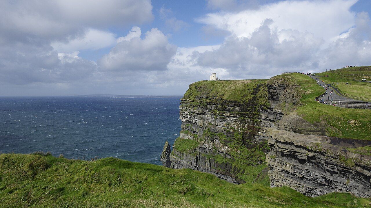
The Cliffs of Moher lie just beyond the southern edge of the Burren, and the change in landscape is immediate. In place of pale limestone terraces, you find dark layers of shale, siltstone and sandstone, laid down in a later period, stacked in bands and cut sharply by the sea. The cliffs stretch for several kilometres along the coast and rise to around 200 metres at their highest point, falling almost sheer to the Atlantic.
The flagstone quarried in this part of Clare, often marked with the wavy trails of creatures that crawled over an ancient seabed, has been used for paving, walls and roofs across the county. Look closely at flagged paths and walls in the area and you may spot similar patterns. They are a reminder that this rock, too, began as mud and sand on the floor of a sea, though a very different sea from the warm, clear one that built the limestone of the Burren.
From the cliff top you look out over the ocean towards the Aran Islands and, on clear days, north to the hills of Connemara and south along the coast of Clare. The sea below can look calm from that height, but the noise of waves striking the base of the cliffs carries upward on still days.
The visitor centre and paths
The main approach is through a visitor centre built into the hillside, with parking, exhibitions and facilities. There is an entry charge. From the visitor centre, paved paths lead north and south along the cliff top, with walls and barriers along the busiest sections.
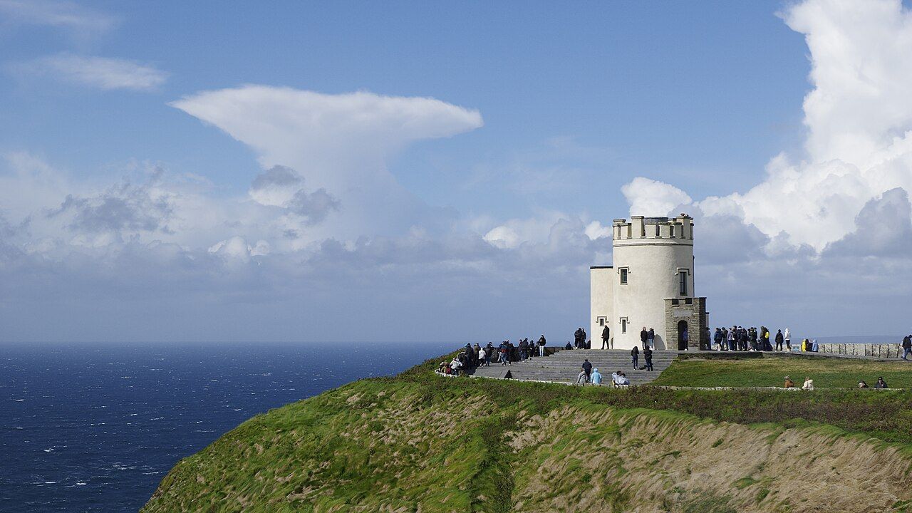
To the north, the path climbs to O'Brien's Tower, a round stone viewing tower built in the nineteenth century by a local landowner for visitors to enjoy the view. It remains one of the most photographed buildings in Ireland. To the south, the path continues towards Hag's Head, becoming quieter and more rugged the further you go.
The walk from Doolin
A coastal path links the cliffs with Doolin to the north, passing through farmland along the cliff edge. It offers a very different experience from the visitor centre, with long views, seabirds and far fewer people. Parts of the path cross private land, and access arrangements have changed in recent years; at times the route has been open only on certain terms or with guides. Follow any local signs and directions.
The path is unfenced for much of its length, uneven and muddy in wet weather, and exposed to strong winds. Wear sturdy footwear, carry water and a windproof, and allow plenty of time. If the weather turns, there is little shelter.
Nearby Kilfenora and the crosses under glass
Edge safety
The Cliffs of Moher are dangerous, and accidents happen. The edges are often undercut and can crumble without warning. Sudden gusts of wind can knock people off balance, and grass near the edge is slippery when wet. Mist can roll in from the sea quickly, making the edge hard to see.
- Stay on the paths and behind walls and barriers at all times.
- Never sit on or lean over the edge, even for a photograph.
- Keep children close and dogs on a short lead.
- In strong winds, mist or heavy rain, keep well back or postpone your walk.
- In an emergency, call the emergency number and ask for the Coast Guard.
Take the warning signs seriously. The view is just as good from a safe distance, and the best photographs usually come from further back, where the whole sweep of the cliffs fits into the frame.
Early or late at the cliffs
The cliffs are one of the most visited places in Ireland, and in summer the middle of the day brings coaches and crowds. Arriving early in the morning or late in the afternoon makes a large difference. The paths are quieter, parking is easier, and the light is softer. In late spring and early summer, seabirds nest on the ledges of the cliffs, among them puffins, which are usually seen offshore or on the stacks below the cliffs; binoculars help.
Evening light can be particularly fine, with the sun dropping to the west over the ocean and lighting up the layers of rock. Note the time of sunset and leave enough time to return to your car in daylight if you are walking far from the visitor centre.
Weather matters more than the season. On a clear day the views are vast; in fog you may see almost nothing. Check the forecast and be flexible: if the morning is grey, another day may be clearer.
Getting there from the Burren
From Ballyvaughan, the most direct route runs south over the hills via the road described in Corkscrew Hill and the Burren roads to Lisdoonvarna, then on to the coast. An alternative follows the coast road west around Black Head and south past Fanore to Doolin, which takes longer but is a fine drive in itself; see Black Head lighthouse and Fanore beach.
Combining the cliffs with time in Doolin or the spa town described in Lisdoonvarna makes a full day without too much driving. By evening you can be back on the shore of Galway Bay, with the dark cliffs swapped for the grey terraces of the northern Burren.