
Doolin and the view to the Aran Islands
A scattered village on the Atlantic edge of the Burren, known for music and the boats that cross to the islands, with a round castle watching from the hill.
Ground: Road and pathFrom Ballyvaughan: Roughly forty minutes by carWay in: Via Lisdoonvarna or the coast roadBring: Waterproof, warm layer, binoculars, seasickness remedy
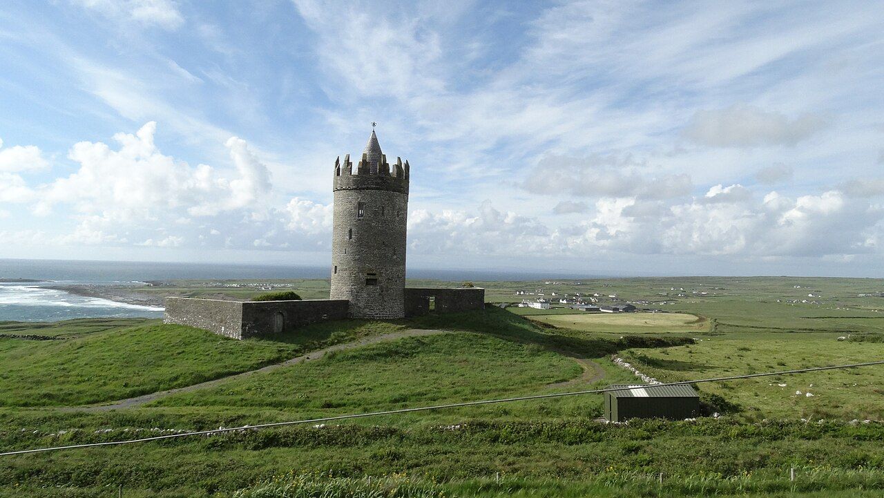
A village in pieces
Doolin is not a compact village with a single main street. It is spread out across a few clusters of houses along the lower valley of the Aille River, running down towards the sea. One cluster stands on higher ground inland, another lies near the shore, and the road between them crosses the river and passes through open fields. Newcomers sometimes drive straight through without realising they have arrived.
The setting is the main appeal. To the north rise the shale-capped hills of the western Burren; to the south the land climbs towards the Cliffs of Moher; and out to the west, across the sound, lie the low grey shapes of the Aran Islands. The village sits in the gap between all of them, with the Atlantic directly in front.
The music tradition
Doolin's reputation rests above all on traditional Irish music. County Clare has long been one of the strongest regions for traditional music in Ireland, with its own styles of playing and a deep store of tunes, and Doolin became one of its best-known centres during the later twentieth century, drawing musicians and listeners from far away.
The heart of the tradition is the session: an informal gathering where musicians sit together and play tunes in turn. Reels, jigs, hornpipes and slow airs follow one another, often without announcement, and a quiet song may be sung unaccompanied between sets. Fiddles, flutes, whistles, concertinas, accordions and bodhráns are common, and the line between performer and audience is not always fixed.
If you go to listen, follow a few simple courtesies. Keep your voice down during slow airs and songs, avoid taking the seats reserved for the musicians, and do not use flash photography. Requests are rarely made in a session, and joining in with an instrument is something to ask about, not assume. Sessions vary with the season and the evening, so ask locally where music is likely.
Nearby Walled farms of the high Burren
The pier and the islands
The pier at Doolin lies at the end of the road near the shore, sheltered behind a curve of rock. From here, in the main season, boats cross to the Aran Islands, the closest being Inis Oírr, the smallest of the three. Some boats also continue to Inis Meáin and Inis Mór, and some run trips along the base of the Cliffs of Moher.
Sailings depend heavily on the weather, and in rough seas they may be cancelled at short notice. Timetables change by season. Bring warm, waterproof clothing for the crossing, since it can be cold and wet on the water even in summer.
The islands themselves are formed of the same limestone as the Burren, cut off from the mainland by the sea. On a clear day from the shore near Doolin you can see their low terraces, and the pale rock looks much like the hills behind you.
Doolin Point and the shore
Near the pier, the coast is a wide expanse of limestone shelves, broken by grikes and pools and pounded by the Atlantic. In winter storms the waves throw spray high over the rocks, and even on calm days the swell surges across the lower ledges. It is a dramatic place to watch the sea, but a dangerous one to walk out on. Stay well back from wet rock, keep children close, and never turn your back on the waves.
On the hill to the south of the village, the coastal path towards the cliffs begins. The route is covered in the Cliffs of Moher from the Burren side.
Doonagore Castle
On a rise above Doolin, overlooking the coast, stands Doonagore Castle: a round tower house surrounded by a small walled enclosure, or bawn. Most tower houses in the west of Ireland are square, so the round form makes Doonagore easy to recognise from a distance, and it appears in countless photographs of the area.
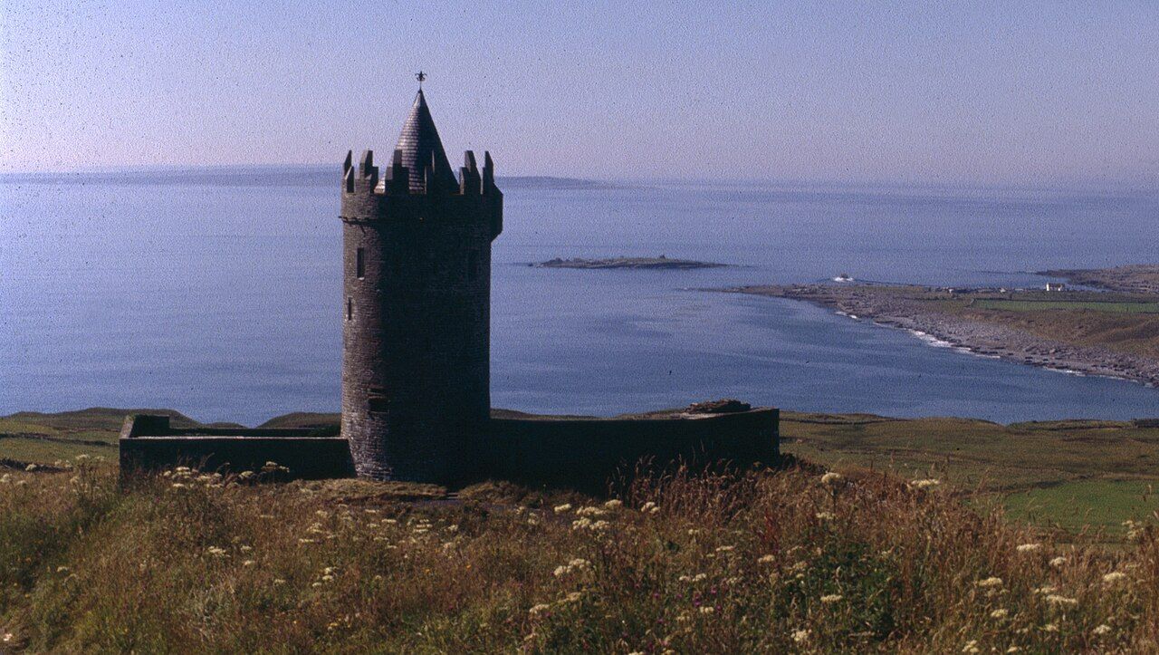
The castle dates from around the sixteenth century, on the site of earlier fortifications, and it was restored in the later twentieth century. It is privately owned and not open to visitors, so view it from the road and do not enter the surrounding land. The views from the road nearby, out across the coast to the Aran Islands, are reward enough.
Other fortified houses in the region, including the ruins near Ballyvaughan and the great shell of Leamaneh, show the variety of these buildings across the Burren.
Around Doolin
Doolin makes a natural stop on a loop from Ballyvaughan. The coast road around Black Head and Fanore, described in Black Head lighthouse and Fanore beach, leads south to the village, and the road inland climbs to the spa town covered in Lisdoonvarna, the spa town. Below the hills just outside the village is a cave holding one of the longest free-hanging stalactites known in Europe, described in the guide to caves and turloughs.
In summer the village is busy, with walkers, island visitors and music lovers arriving through the day. Spring and autumn are quieter, though some services reduce their hours or close in the off season. Whatever the season, come with time to spare: the best of Doolin is the sea, the light on the islands and an evening of music, none of which can be rushed.