
Walled farms of the high Burren
Round stone enclosures built by well-off farming families more than a thousand years ago. How to read them, where the law school stood, and the fort that hangs over a valley.
Ground: Grassy and roughFrom Ballyvaughan: Fifteen to twenty-five minutes by carWay in: R480 and side roads south of BallyvaughanBring: Boots, a map, a waterproof
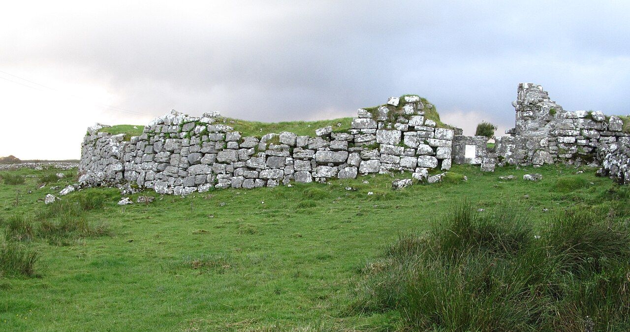
Scattered over the uplands of the Burren are hundreds of round enclosures, some no more than a ring of tumbled stones in a field, others with walls still higher than a person. Most were farmsteads. In the centuries of the early medieval period, roughly from the middle of the first millennium onwards, families with cattle and standing built themselves a circular wall, lived in houses inside it, and kept their animals close at night. Earthen versions of the same idea are found all over Ireland. Here, where soil is thin and stone lies everywhere, they were built of limestone and are usually called cashels or, in place names, caher.
Three of them are worth seeking out. Each has a different character and a different story, and together they give a clear picture of how people lived on this ground long after the builders of Poulnabrone were gone.
What a cashel was for
The wall of a cashel was not a castle wall. It kept cattle in and raiders out, but its main job was probably to say something: that the family inside was settled, prosperous and worth respecting. Wealth in early Ireland was counted largely in cattle, and the laws of the time set out in detail how a farmer's rank rose and fell with his herds, their houses and their obligations.
Inside the wall stood round or rectangular houses of stone, timber and thatch, with hearths, storage pits and sometimes souterrains, underground passages used for storage or refuge. Little of this survives above ground. What you see today is mostly the enclosing wall, built dry without mortar, with an inner and outer face and rubble between.
Many cashels sit on slight rises with good views over the surrounding land. Walk up to one and turn around, and you will often see two or three others on nearby slopes, a reminder that this was a busy, settled landscape rather than an empty one.
Caherconnell
Caherconnell lies just off the R480, not far south of Poulnabrone, which makes it easy to combine the two. The fort is a well-preserved example, with a thick, high wall and a clear entrance. Excavation there in recent decades has suggested that it was lived in for longer than many of its neighbours, into the later medieval period, and that its occupants were people of some importance.
Access to the fort itself is through a heritage site by the road with its own charges. Even from outside you can see how the fort sits within a web of older field walls. Some of these walls run straight into the hillside and vanish under scrub; others meet the fort at angles that hint at boundaries now lost.
Cahermacnaghten and the law school
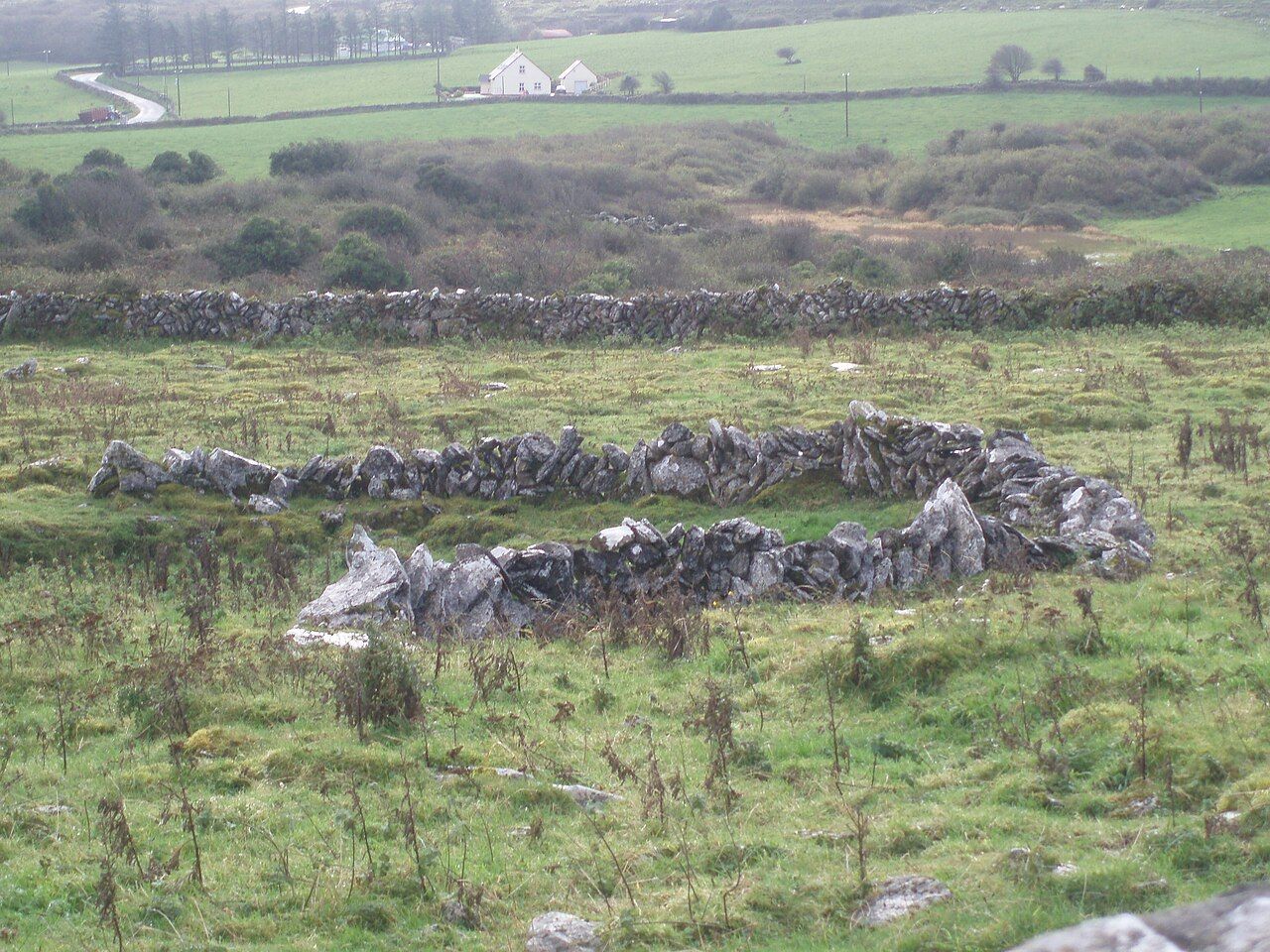
Cahermacnaghten is quieter, a broad stone ring in farmland in the northern uplands, with grass inside and a gap where its gateway once stood. It is not large or dramatic, but it has an unusual history. In the later medieval centuries it was home to the O'Davoren family, hereditary lawyers who taught the old native law of Ireland, usually called Brehon law, to students who came to study with them.
Nearby Kilfenora and the crosses under glass
Manuscripts linked with the family survive, and they show a world of careful argument over property, injury, contracts and status. It is a striking thought that, in this plain stone enclosure on a windy rise, young men once learned legal texts by heart and copied commentaries by hand. The buildings they used are long gone, and the ruins of later structures inside the walls are hard to read, but the setting has changed less than you might think.
The fort is on private land. Look from the roadside or a public way unless you have permission, and close any gate you pass through. As everywhere in the Burren, ask before you cross fields.
Cathair Chomáin on the cliff
The most dramatic of the three is Cathair Chomáin, often written in English as Cahercommaun. It stands on the very lip of a limestone cliff above a deep valley, near Carron in the east of the Burren. Instead of one wall it has three, set one inside another, with the innermost and strongest wall built in a curve against the cliff edge so that the drop itself completes the circle.
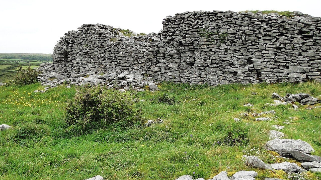
The fort was excavated in the twentieth century and is usually dated to around the ninth century. Finds suggested a community that kept large numbers of cattle and did a good deal of craftwork, and the scale of the site points to a family or group of real power in the region.
Reaching it means a walk over rough ground from a small parking area. Wear proper footwear, take care near the edge, and keep well back from the drop, especially in wind or rain. The grass hides loose stones, and the cliff is sheer. On a clear day the reward is a view across the valley to the folded hills around Mullaghmore.
Reading the stones yourself
Once you have seen a few cashels, you start to notice them everywhere. Look for these signs:
- A circular line of stones or a curved wall that does not match the straight lines of modern fields.
- A gap with larger stones on either side, often facing east or south: a former entrance.
- Bright green grass inside a ring, a sign of richer soil built up by people and animals over centuries.
- Older, lower walls running away from the fort, the remains of fields worked by the same households.
Do not climb on the walls. Dry-stone work holds by its own weight and balance, and a single dislodged stone can start a collapse that takes a farmer days to rebuild, if it can be rebuilt at all. Never take stones away, and never add to the little piles that visitors sometimes build.
Putting a day together
A good half day starts at Poulnabrone, moves on to Caherconnell close by, and continues south and east towards Carron for the walk to Cathair Chomáin. Cahermacnaghten fits more easily into a drive through the upland lanes on another day. If you have time, end at Leamaneh, where the story moves on to the tower houses of later lords.
Weather on the high ground can turn quickly, and fog comes in off the sea with little warning. Carry a map, know where you parked, and let the forts be part of a slow day rather than a checklist.