
Mullaghmore and the national park
The folded grey dome of Mullaghmore is the emblem of the national park, a hill whose curving layers of rock make every step of the climb a lesson in geology.
Ground: Bare limestoneFrom Ballyvaughan: Around forty minutes by carWay in: By car via Carran or KilnaboyBring: Boots, waterproof, map, water, compass or offline map
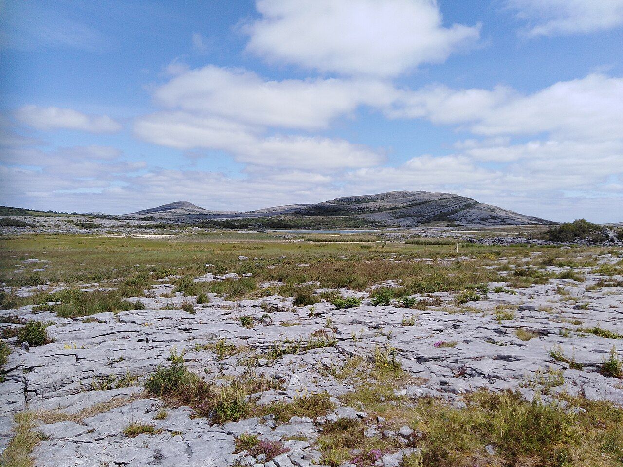
A hill made of folds
Most of the Burren's limestone lies in nearly flat beds, stacked like the pages of a closed book. Mullaghmore is different. Here the layers bend and curve, sweeping up and over the hill in great arcs, so that from a distance the summit looks like a grey wave about to break. Earth movements long ago pressed the beds into these folds, and erosion has since stripped the hill bare enough to show them plainly. The hill is not high, yet it dominates the low country to its south and east because nothing around it has quite the same shape.
Around its base lies a mixture of habitats that changes every few hundred metres: open pavement, hazel scrub, small ash woods, calcareous grassland, fen and shallow lakes. That variety is a large part of why this corner of Clare became the heart of Burren National Park.
The national park
Burren National Park covers a section of the south-eastern Burren, centred on Mullaghmore and the lakes beside it. It is state land managed for conservation, and unlike much of the region you are free to walk on it, as long as you follow the waymarked routes and the park's guidance. The park has an information point in the village of Corofin, normally open in the main season, where you can pick up advice on the trails and current conditions.
There is no large visitor centre at the hill itself. You park in small areas along narrow local roads and walk from there. Spaces fill on fine weekends in May and June, so arrive early, and never block a gate or a farm entrance, even for a few minutes.
The waymarked loops
Several trails start near the hill, marked with coloured arrows on low posts. The shorter ones keep to the lower ground, passing through scrub, along the shore of a lake and across sections of pavement, and they suit anyone happy on uneven ground. The longest and most demanding route climbs onto Mullaghmore itself, working up the terraces to the top and down again by a different line. That ascent involves steep steps of rock, loose stones and stretches where the route is only a series of posts across bare pavement.
Distances look modest on the map, but walking on limestone is slow. Allow far more time than you would on a path of similar length, and decide before you start which loop fits your fitness, your footwear and the weather. If you only have a short time, a lower loop will still give you the views of the folded hill that make the place famous.
Nearby Leamaneh and the tower houses of the Burren
Lakes that come and go
South and west of the hill lie a string of shallow lakes, Lough Gealáin among them, its water often a striking pale blue-green over a floor of lime-rich sediment. The water levels here rise and fall with the seasons and with the rain, because much of the drainage happens underground through the limestone. Some of the nearby hollows behave as turloughs, filling in winter and draining away in summer to leave damp grassland. The way water moves through this rock is explained more fully in the guide to caves and turloughs.
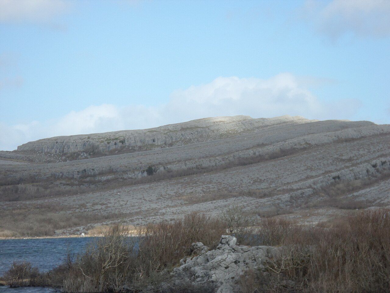
The lakes attract waterbirds, and the fen and grassland around them carry many of the plants found across the region. In late spring you can see gentians and orchids along the edges of the trails, but stay on the waymarked line and leave every plant where it grows. The broader flower story is in the spring flowers of the Burren.
Terrain and navigation
The ground on and around Mullaghmore is a fine example of the pavement described in the limestone pavement guide, with deep grikes, rocking slabs and smooth surfaces that become slippery after rain. The terraces on the hill end in short drops that are easy to miss in poor light. Wear boots with good ankle support and keep your eyes on your feet whenever you are moving.
Navigation is the bigger risk. Bare pavement looks much the same in every direction, and when cloud drops onto the hill or rain sweeps in from the Atlantic, the landmarks that seemed obvious an hour earlier disappear. Carry a map and compass or an offline map on a charged phone, note where you parked, and follow the posts rather than heading off on a line that looks shorter. If you lose sight of the next marker, stop and look back for the last one before going further.
- Check the forecast on the morning of your walk and turn back if visibility drops.
- Carry water and food; there are no facilities on the trails.
- Keep dogs on a short lead because of livestock and ground-nesting birds.
- Do not build cairns or move stones to mark a route.
Getting there and combining the day
From Ballyvaughan the usual approach heads south past the high plateau of the central Burren, then east through the country around Carran or by way of Kilnaboy, depending on your map. The final roads are narrow, with grass down the middle in places and few passing points, so drive slowly and pull in for oncoming vehicles. Satellite navigation sometimes chooses tracks unsuitable for cars, so look at a road map as well.
The national park makes a good pairing with the villages and lakes to the south, covered in Corofin and the southern lakes. A morning on the trails followed by a slow drive past the water is a full day without hurry. If the weather turns, the information point in Corofin and the churches and ruins scattered along the roads offer shelter and plenty to see.