
Reading the limestone pavement
From the road the grey rock around Ballyvaughan looks bare. Up close it is a record of an old sea, moving ice and slow rain, with small gardens in its cracks.
Ground: Bare limestoneFrom Ballyvaughan: Starts at the edge of the villageWay in: On foot or a short driveBring: Boots with ankle support, a hand lens, a windproof
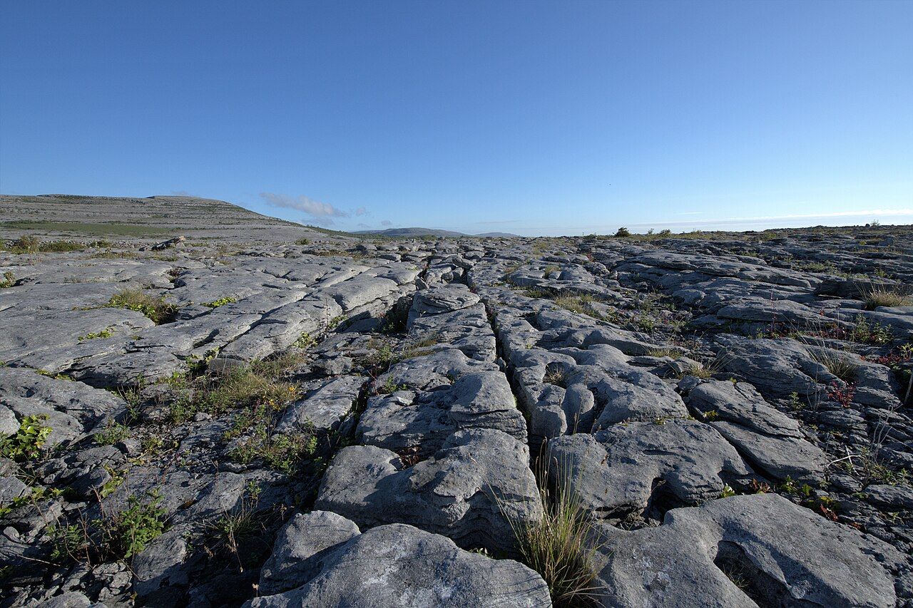
A seabed lifted into the air
Stand on any open stretch of the Burren and you are standing on the floor of a vanished sea. The limestone formed in the Carboniferous period, roughly 330 million years ago, when this part of the earth lay close to the equator under warm, shallow water. Shells, corals and the stems of sea lilies settled on the bottom over immense spans of time, and the layers slowly hardened into rock. Look closely at a weathered surface and you will often find them: small rings and discs that were once crinoid stems, the ribbed outline of a shell, the honeycomb pattern of a coral.
Later movements in the crust raised those beds and tilted them only slightly. The result is the stepped look of the hills above Ballyvaughan, where terraces of pale rock climb in bands like the courses of an enormous unmortared wall. From the bay road the slopes can seem uniform and grey. Walk up onto them and that uniformity breaks into detail almost at once.
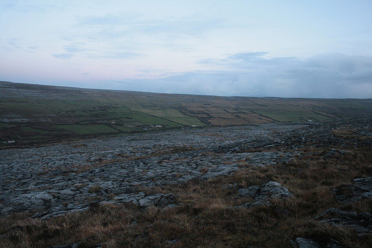
Clints, grikes and the work of ice
Two words are worth learning before you set out. A clint is a block or slab of the pavement, the flat part you walk on. A grike is the fissure between clints, a slot that may be a hand's width across and anything from a few centimetres to well over a metre deep. Seen from above, a good stretch of pavement resembles paving laid by a careless giant, the grikes running in roughly parallel lines with shorter cross-cuts between them.
Ice did much of the preparation. During the last glaciation, sheets of ice moved across the region, scraping away soil and loose rock and leaving the limestone planed and exposed. When the ice melted it dropped whatever it had been carrying. Those stranded boulders are glacial erratics, and the Burren has plenty of them: rounded stones perched on the pavement as if someone had set them down a moment ago. Many are limestone themselves, while some are of rock types that do not belong here at all, dragged in from elsewhere by the moving ice. An erratic sitting on a low pedestal of pavement is a clue that the surrounding surface has been lowered by weathering while the boulder sheltered the patch beneath it.
Rain has done the rest. Rainwater picks up carbon dioxide from the air and the soil and becomes weakly acidic, and limestone dissolves in it, very slowly. The water finds the joints in the rock, widens them and drains down into the ground rather than running across it. Over thousands of years the joints became grikes, and the tops of the clints developed runnels, pits and shallow basins that hold water after a shower. This is what geologists mean by karst: a landscape shaped more by solution than by surface rivers. Where the water goes next is a story of its own, told in the guide to swallow holes and turloughs.
Why the cracks are green
The pavement looks hostile to plants, yet the grikes are among the richest habitats in the region. Down in the fissures the air is still, humidity stays high and the temperature swings less than on the open rock. Soil and leaf litter collect at the bottom. Ferns thrive there, including hart's-tongue with its glossy, strap-shaped fronds and the fine maidenhair fern, which is scarce in most of Ireland. Look down a deep grike and you may see a small woodland in miniature: ivy, wood sorrel, hazel seedlings and mosses, all out of the wind.
Look down a deep grike and you may see a small woodland in miniature: ivy, wood sorrel, hazel seedlings and mosses, all out of the wind.
On the clints themselves, plants hold on wherever a little soil gathers in a hollow. Low cushions of wild thyme, mats of mountain avens and tufts of grass take advantage of the warmth the rock releases after a sunny day. The finest flowering comes in late spring, and the spring flowers deserve a visit planned around them.
Nearby Mullaghmore and the national park
Places to read the rock
You do not need to go far. The slopes rising behind Ballyvaughan and the hills towards Black Head carry broad terraces of pavement, and the coast road gives long views of them stepping down to the sea. Much of this ground is private farmland, so keep to waymarked routes such as sections of the Burren Way, and ask before crossing any field that is not on a marked path.
The national park in the south-east of the Burren has some of the most striking scenery of all, with open pavement, shallow lakes and the folded mass of Mullaghmore. Its waymarked trails start from small parking areas on the local roads and cross exactly the kind of ground described here.
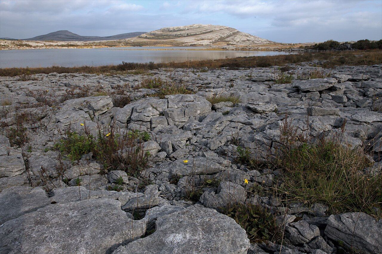
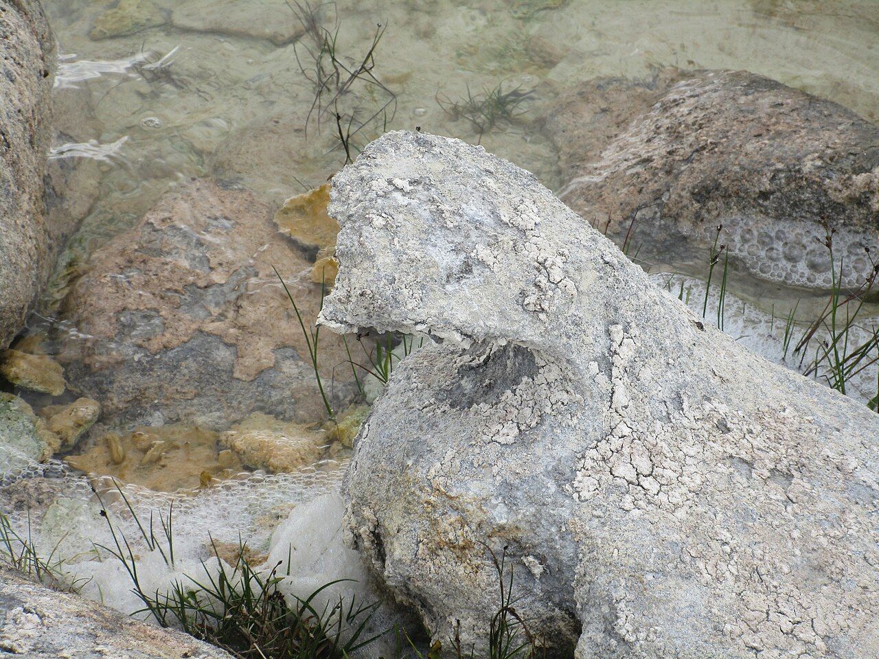
Near Lough Gortlecka, in the same corner of the park, you will find stranger shapes: boulders whose lower parts have worn narrower than their tops, so that they stand like stone mushrooms. Weathering seems to work faster at the base, where the rock stays damp for longer, leaving a cap balanced on a neck. Treat these forms gently, climb on nothing that looks fragile, and leave them exactly as you found them.
A trip to the Poulnabrone portal tomb, which stands on open pavement in the high central Burren, shows how early farmers built with the slabs this ground already offered them.
Walking on pavement safely
Limestone pavement is harder going than it looks. Grikes can be deep enough to break an ankle or a leg, and grass or overhanging plants often hide them. Some clints rock when you step on them; you hear the hollow knock before you feel the movement. After rain, or in the damp air that drifts in from Galway Bay, the smoother surfaces become slippery, and wet lichen makes them worse.
- Wear boots with firm soles and good ankle support rather than trainers or sandals.
- Step on the middle of the clints, test loose slabs before trusting your weight to them, and never jump across a wide grike.
- Keep the pace slow; distances over pavement take far longer than the map suggests.
- Check the forecast, carry a waterproof and a warm layer, and turn back if mist comes down, since open pavement offers few landmarks.
- Tell someone your route and your expected return, and carry a charged phone, knowing that coverage is patchy in places.
Leave it as you find it
The pavement is protected habitat, and much of it lies within farms that people work every day. Never pick flowers, dig up plants or lift stones, and do not shift rocks to frame a better photograph. Do not build cairns either: stacked stones damage the surface, disturb the plants and small creatures beneath, and can mislead walkers who rely on the few genuine markers on the hills. Close gates behind you, keep dogs on a lead near livestock, and use stiles where they exist instead of climbing the dry-stone walls, which collapse easily.
If you want something to take home, take photographs and notes. A hand lens adds a great deal: fossils on the surface of a clint, the textures of lichen and the tiny flowers in a cushion of moss all repay close attention. Return in another season and the same patch of rock will show you something different.